Page 11 of 11
Re: Maps, Maps, Maps
Posted: Wed May 31, 2017 7:28 pm
by Senya
Here's a map of Fort Kolgrad. Fort Kolgrad contains within it two "Military-only" regions, The Fort and the Military District, whilst the town of Nordkamp is also primarily a military town. The Animal Reserve and Tsännerlauger are national parks with human activity legally minimised, with only really Old Fort Kolgrad, Hampton, Redditch, Tzult, Lamnstadt and Regensburg being normal regions. Whilst the whole of Fort Kolgrad is very mountainous, the Bergdorf Corridor is littered with them and as such Bergdorf town is the only settlement in this area, and it is a winter sports magnet, with many people coming in the winter on ski trips whilst the summer is very much a great time to hike.

Note: with the exception of Dalek Bay, only towns and military settlements are shown on this map. Only Inter-town main roads and public airports are shown. Military airports and roads, private roads, tracks, roads within towns and non-main roads are not shown.
Re: Maps, Maps, Maps
Posted: Mon Jul 31, 2017 12:17 am
by NewZimiaGov
A fancy map of Corum featuring, climate, topography, and roads connecting all major cities/ruins.
http://micras.org/wiki/images/thumb/1/1 ... telite.png
Re: Maps, Maps, Maps
Posted: Tue Aug 01, 2017 3:22 am
by Ryker
This is an update from one Kras made years ago.
Re: Maps, Maps, Maps
Posted: Wed Aug 02, 2017 3:57 am
by Ryker
Also, I found
this during some internet archeology. Go ahead and click "here" on it. It wouldn't let me put up the actual picture or direct link here for some reason.
Re: Maps, Maps, Maps
Posted: Wed Aug 09, 2017 4:22 am
by Ryker
Anyone who wants to use this, please feel free. It was a joy to make and wouldn't seem fair to have it all for myself.
Re: Maps, Maps, Maps
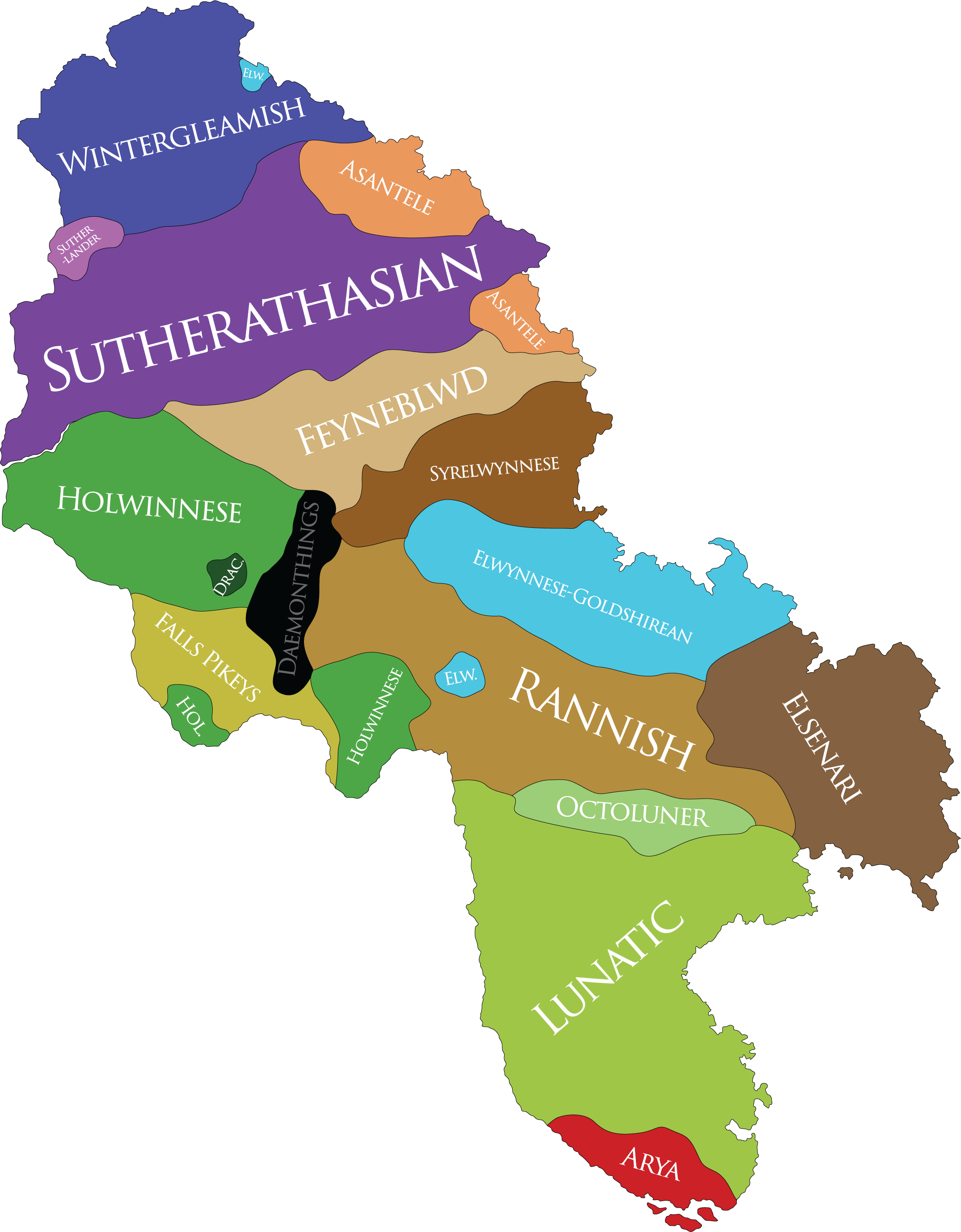
Posted: Tue Oct 03, 2017 6:16 pm
by Ryker
Ethnographic map of Benacian Goldshire:
Re: Maps, Maps, Maps
Posted: Sun Apr 28, 2019 3:15 pm
by kemal HagemaruFRP
This is a territorial map of Federal Republic of Phinbella.....
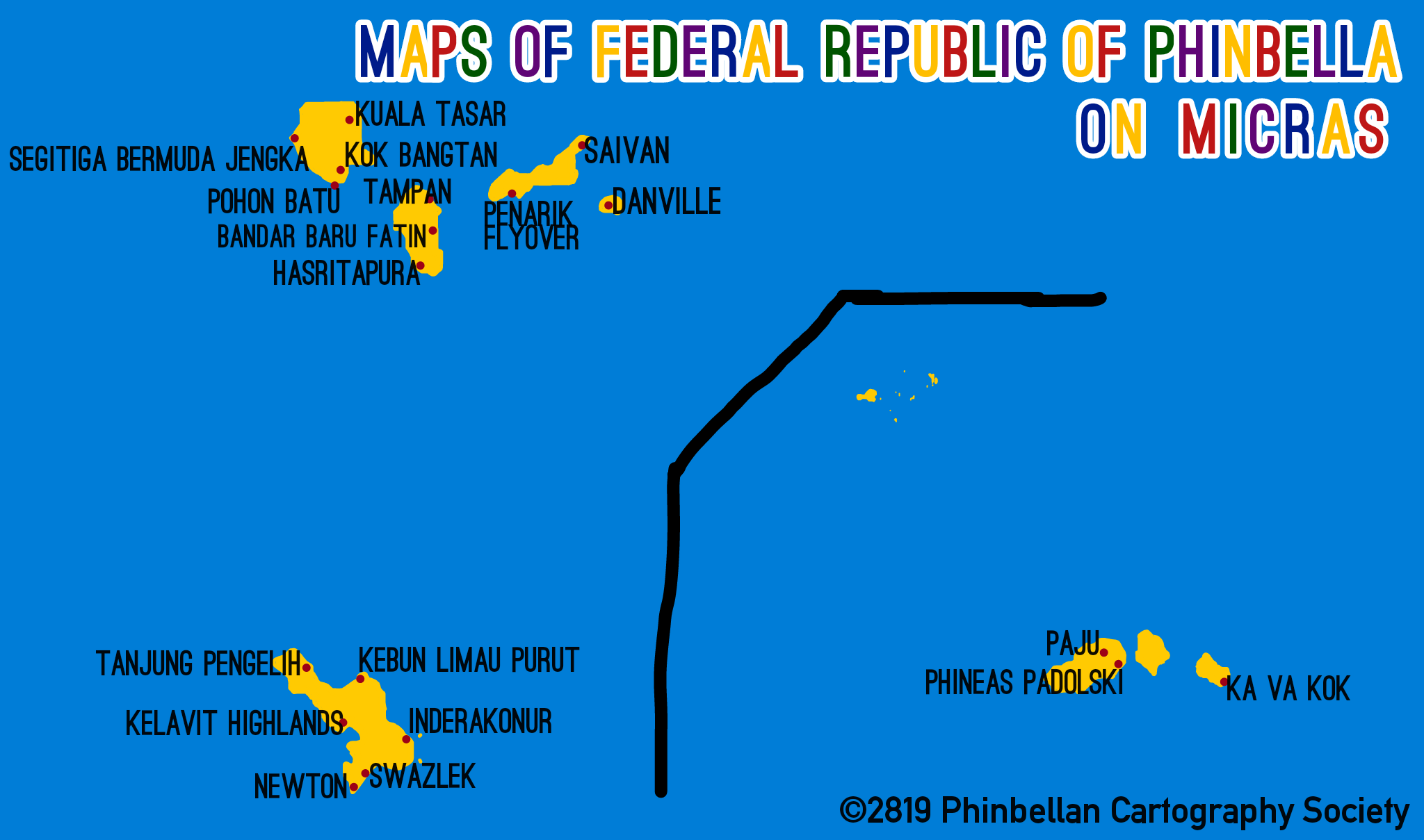
They are had 19 city and town on this map

Re: Maps, Maps, Maps
Posted: Wed May 15, 2019 9:06 pm
by Jonas Windsor
Re: Maps, Maps, Maps
Posted: Mon Jun 03, 2019 8:20 pm
by Gustaaf Vermeylen
The map of Batavia and Kasterburg, as far as mapped. The Brettish Isles with the parts of Amokolia, Nova England and Unified Governorates of Benacia (New Blackstone):

Source:
https://micras.org/wiki/images/0/03/Bat-Kas5.png
Re: Maps, Maps, Maps
Posted: Sat Aug 03, 2019 4:03 pm
by Gustaaf Vermeylen
Batavia has been mapped. The Brettish Isles with the parts of Amokolia, Nova England and Unified Governorates of Benacia (New Blackstone):

Source:
https://micras.org/wiki/images/5/57/Bat-Kas6.png
