Page 6 of 11
Re: Maps, Maps, Maps
Posted: Mon Feb 04, 2013 5:50 pm
by Jack
Here is a map of the Southbatavian island of Calbion:

Re: Maps, Maps, Maps
Posted: Sat Aug 10, 2013 11:35 pm
by pawelabrams
Lucerne, Mercury by ITaKa (Interlandian Cartography Society)
EDIT:
https://www.dropbox.com/s/o8hsh4pdbadhxhp/Lucerne.png
Re: Maps, Maps, Maps
Posted: Sun Aug 11, 2013 11:54 am
by Joe
Error 404

Re: Maps, Maps, Maps
Posted: Sun Aug 11, 2013 2:30 pm
by pawelabrams
Umm... Dropbox anti-hotlinking measures. I'll just drop the casual share link here then.
Re: Maps, Maps, Maps
Posted: Mon Aug 12, 2013 9:16 am
by Hālian
That map is beautiful, Pawel.

Re: Maps, Maps, Maps
Posted: Mon Aug 12, 2013 11:17 am
by pawelabrams
Thank you

I'm open for free comissions 'til 26th (end date of a project).
Re: Maps, Maps, Maps
Posted: Mon Aug 12, 2013 11:27 am
by Joe
How about fixing up the rest of the island then

Re: Maps, Maps, Maps
Posted: Sun Sep 08, 2013 10:04 pm
by NewZimiaGov
Here's a map I've been working on of the Haifan Wallis Islands. I'm pretty happy with it.
http://i.imgur.com/POwa8P3.png
Edit: It's actually a result of a joint operation between the Pallisican Cartography Society, which is a Passasian company, and Corum Expeditions, which is a Haifan company, owned and operated in Wallis Island. In case anyone was curious.
Re: Maps, Maps, Maps
Posted: Sun Sep 08, 2013 11:39 pm
by Joe
The Wallis map seems kinda crowded.
Re: Maps, Maps, Maps
Posted: Mon Sep 09, 2013 12:09 am
by NewZimiaGov
Oh, its definitely crowded. I probably should have used smaller font. That said, it still accomplishes its purpose. All it really needs is a sense of scale and a compass rose.
Re: Maps, Maps, Maps
Posted: Mon Sep 09, 2013 12:12 am
by Liam Sinclair
It's a good map, but as you said, perhaps a smaller font to lessen the crowding would be beneficial. Is this going to be integrated into the interactive map of Hamland site at some point in the future?
Re: Maps, Maps, Maps
Posted: Mon Sep 09, 2013 12:18 am
by NewZimiaGov
I hadn't thought about it, but that is a good idea. Most likely, yes. I think that it has a lot of potential.
Re: Maps, Maps, Maps
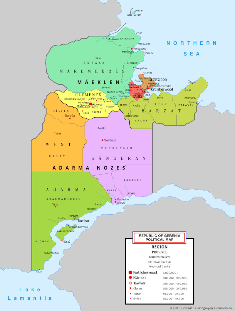
Posted: Wed Sep 25, 2013 7:47 pm
by Gerenia
Well, it took me like four days, but I've made a detailed political map of Gerenia.
Here it is.
Re: Maps, Maps, Maps
Posted: Thu Sep 26, 2013 10:16 am
by pawelabrams
That's one fine map, sir.
...
Really, it's awesome.
Re: Maps, Maps, Maps
Posted: Sun Sep 29, 2013 9:21 pm
by Senya

Not the greatest map, and misses off two national parks in Fort Kolgrad, but it shows our protected areas.